 The American Immigration Council is a non-profit, non-partisan organization.
An immigration law office, a courthouse, a workplace, a healthcare provider, a shelter, or a religious event can reveal sensitive information about an individual and their life. But in the age of widespread digital data collection, the location data can also become the starting point of an investigation. Instead of identifying a person and tracing their individual movements, law enforcement can start with a place and a time and ask a different question: Who was there at that time? That is the basic idea behind a geofence search.
For immigration enforcement, the implications are easy to imagine. The Electronic Frontier Foundation has specifically pointed to visits to immigration legal clinics as an example of why access to commercial location data can create serious privacy risks.
The U.S. Supreme Court established important boundaries on how law enforcement can use location data during its most recent term.
What is geofencing?
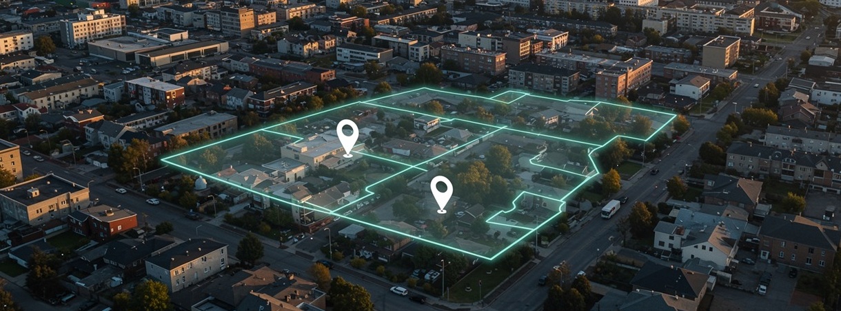
A geofence is a virtual boundary drawn around a geographic area. In a geofence investigation, authorities specify a location and a time period and obtain information about devices that were present within that boundary.
A geofence search reverses the traditional investigative process: search the data first and identify a suspect second. Google’s location data provides one of the best-known examples of how this has worked. As described by the majority opinion in Chatrie v. United States, a traditional geofence search generally involves several stages.
First, Google searches its location database for devices that appeared within a specified geographic area during a particular period. Investigators receive anonymized device information, narrow the list to devices they considered relevant, and then ask Google for identifying information associated with the selected accounts. Law enforcement typically seeks a warrant from a magistrate that outlines these steps and allows Google to provide the location data to police.
The role of AI
Geofencing itself is not artificial intelligence. Drawing a geographic boundary and searching location records can be done with a conventional database search.
However, law enforcement agencies can leverage AI to analyze location records alongside other data sources. A single location record may tell an investigator that a device was in a particular place at a particular time. Investigators can cross-reference location information with license-plate reader records, facial recognition results, addresses, social media, and government databases. AI and other analytical tools can help investigators process these large datasets, identify potential matches, and uncover connections that would be difficult to find manually. Geofencing creates the haystack. AI helps investigators search it.
Supreme Court’s ruling on geofencing and privacy
In May 2019, a bank was robbed in Midlothian, Virginia. Surveillance footage indicated that an individual, suspected to be the robber, walked into the bank while talking on their cellphone. Without any substantive leads after almost a month of investigating, the Midlothian Police Department obtained a geofence warrant directing Google to provide information for devices that appeared within150 meters of the bank around the time of the robbery.
With this warrant, investigators conducted a reverse search, beginning the investigative process by sifting through the private location data of all individuals in the vicinity of the bank to identify potential suspects.
Google identified 19 anonymized accounts through this search and later provided identifying information for three individuals, including Okello Chatrie who was ultimately charged and convicted of the robbery.
His lawyers challenged the geofence search as unconstitutional under the Fourth Amendment, which protects all individuals’ privacy against unreasonable searches and seizures and requires that warrants describe the location to be searched. Chatrie’s lawyers argued that the government’s request for Google’s geofence data represented an unreasonable and invasive search that violated the privacy rights of all individuals within the vicinity of the bank. The government, however, argued that asking Google for geofence data was not a search under the Fourth Amendment.
In a 6-3 ruling, the Supreme Court held that accessing this geofenced location data constitutes a search under the Fourth Amendment. Therefore, the Court found that people have a right to privacy for their personal location data even when a company possesses it.
Importantly, though, the Supreme Court only answered the question of whether the government’s request for the location data was indeed a search. Under Fourth Amendment jurisprudence, the government may conduct searches as long as they are reasonable. The Court returned the case to the Court of Appeals to determine whether the three-step geofence warrant met this standard.
The Chatrie decision relied on the Court’s 2018 ruling in Carpenter v. United States, which concerned the Federal Bureau of Investigation’s warrantless acquisition of cell-site location data. In Carpenter, the Court found that accessing cell-site location data constituted a Fourth Amendment search, and that accessing such data without a warrant supported by probable cause constitutes an unconstitutional invasion of privacy.
The Carpenter and Chatrie cases illustrate an important shift in investigative direction and in the breadth of privacy safeguards:
- In Carpenter, investigators identified a person and obtained records from cellular companies (without a warrant) that showed which towers the individual’s phone connected to, providing a general sense of the person’s location to link them to a crime.
- In Chatrie, investigators began with a broad time and geographical area the size of “several football fields,” directed a warrant to Google for the location records of all devices in the vicinity, and identified potential suspects based on those records.
That distinction illustrates a broader change in digital surveillance: large databases allow investigators to search across information about many people to generate leads, rather than beginning only with a known suspect.
By defining law enforcement’s use of geofence location data as a search under the Fourth Amendment, the ACLU asserts that the Chatrie decision may help protect against law enforcement’s unbridled use of emerging technologies in widespread surveillance. These protections are crucial as the boom in criminal law enforcement technologies comes with substantial risks for arrests based on faulty technology and hyper-surveillance of immigrants and citizens. Even if a criminal arrest does not end in a conviction or formal charges, encounters with law enforcement are often the first step into the deportation process.
Importantly, the protections afforded by the Chatrie decision have not been applied to other surveillance technologies frequently used by criminal law enforcement and U.S. Immigration and Customs Enforcement (ICE). Reporting in 2025 found that ICE frequently uses law enforcement databases and technology, such as AI-enabled camera and automated license plate reader data — none of which require a warrant for accessing as of September 2026.
The technological and financial resources afforded to immigration enforcement agencies exacerbate this gap in protections. Immigration enforcement increasingly uses biometric databases, investigative platforms, GPS monitoring, license-plate information, commercial datasets and other government records to identify and arresting immigrants.
Chatrie affirms the sensitivity of location information and the importance of protecting individuals’ constitutional privacy protections at a time when immigration enforcement has increasingly relied on “indiscriminate raids” that “target locations, rather than particular people” and has gained powerful tools capable of analyzing location and other personal data.
The unresolved immigration question: commercial location data
Chatrie leaves an important question unanswered.
Government agencies can obtain location information from sources other than Google, including by purchasing access to commercially collected data. Apps and advertising networks can collect location information that eventually makes its way to data brokers, which aggregate and sell that information. Government agencies have been among their customers. In immigration enforcement, records obtained by the ACLU show that ICE, CBP, and other parts of the Department of Homeland Security have purchased access to large amounts of cellphone location data collected from smartphone apps.
That creates a potential gap between the privacy principle recognized in Chatrie and the much larger commercial data ecosystem. Chatrie’s holding only applies when the government seeks sensitive cellphone location information from a technology company. However, what happens when an agency purchases access to similar information from a commercial data broker?
The distinction matters because information about people’s movements is collected not only by cellphone providers and companies like Google, but also by apps, advertising networks, license-plate readers, and other systems.
For immigrant communities, the gap between privacy protections and data collection can have real consequences. An immigration legal clinic, a courthouse, a shelter, or a place of worship can become a starting point for enforcement. Whether Chatrie’s protections hold up in practice will depend on how courts and lawmakers answer the question it left open: Can the government buy information that it would otherwise need a warrant to obtain?